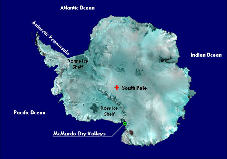
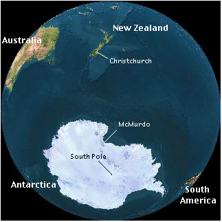
Where
is Antarctica?
Quick
facts about Antarctica
Size: 5.5 million
square miles (14M sq. km). Fifth largest continent in the world. As
large as the US and Mexico combined.
Government: Antarctica
has been administered by the Antarctic Treaty since 1961. No country
has any definitive sovereignty over any part of it, in spite of claims.
Highest Point:
Vinson Massif 16,062' (4897m)
Precipitation:
Antarctica receives less than 5 cm of precipitation a year, which
is similar to the amount the driest part of the Sahara Desert receives.
Visitors:
Summer - 20,000 visitors and station workers.
Winter - 1,200 “winter over” station workers.
Temperature:
Record low of -128°F (-89.6° C).
Health Risks:
Hypothermia, frostbite, snow-blindness, dehydration, sunburn.
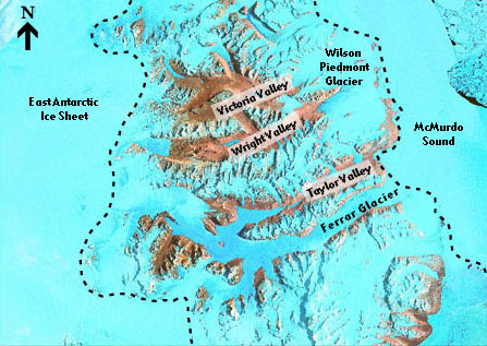
Where
are the Dry Valleys?
Located among mountains
by McMurdo Sound, on the part of Antarctica closest to New Zealand,
the valleys receive the equivalent of only 6 mm of water, on average,
each year in the form of snow.
Completely devoid of
terrestrial vegetation, the region is considered one of the most extreme
deserts on the planet.